The Kedarnath Yatra is a ~16 km walk to a shrine at 3,583 m — here's how we pace the trek, handle the mandatory e-pass and respect the altitude.
In this article
- What the Kedarnath Yatra actually is
- How to reach Gaurikund
- Registration and the e-pass — do not skip this
- Trek day: how we pace it
- The altitude reality
- When to go
- What to carry
- Frequently asked questions
- How long is the Kedarnath trek?
- Is registration compulsory for Kedarnath?
- What is the altitude of Kedarnath?
- When does Kedarnath open in 2026?
- Can I avoid the trek?
- Which is the best month for the yatra?
- Plan it with us
Every year we watch first-timers arrive at Gaurikund treating the Kedarnath Yatra like a temple visit with a long walk attached. It isn't. It's a proper high-altitude trek to a shrine that sits at roughly 3,583 metres, and the people who struggle most are usually the ones who underestimated the distance, the cold, or the paperwork. This guide is the honest version — what the trek actually asks of you, how the registration works, and where people go wrong.
What the Kedarnath Yatra actually is
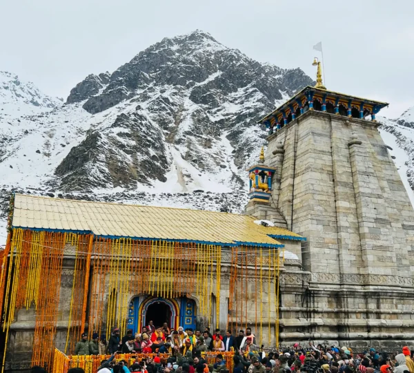
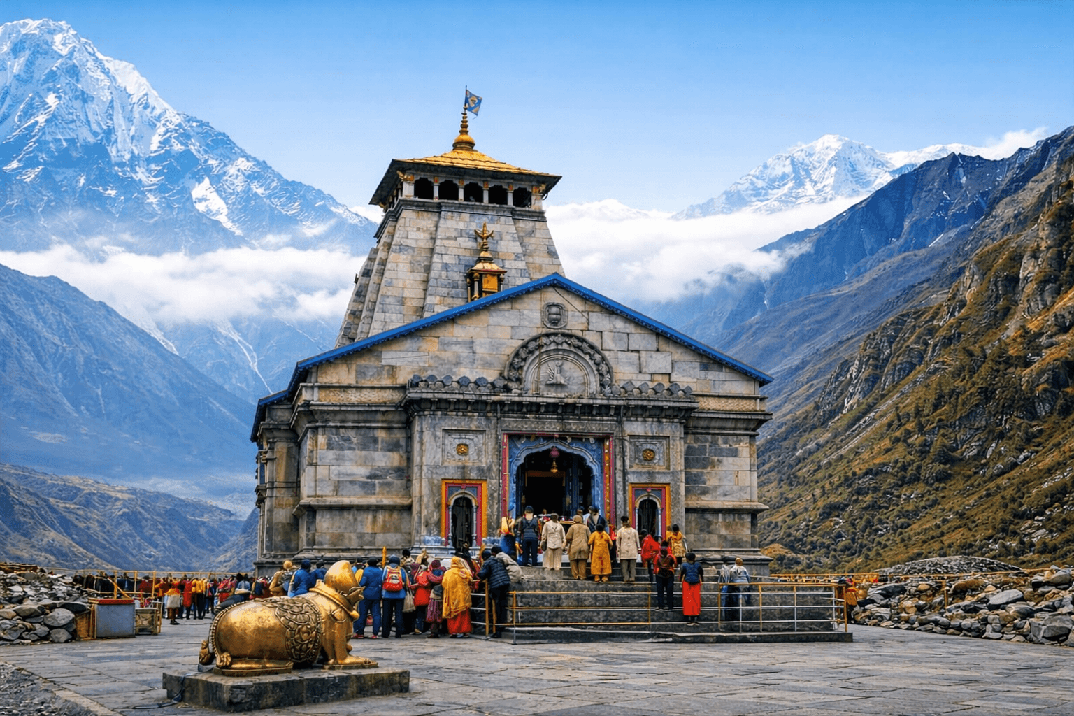
Kedarnath is one of the four Char Dham shrines and, at around 3,583 m, the highest of the Panch Kedar temples. The temple stays open for roughly seven months: for 2026 the portals are expected to open on 22 April and tentatively close around 11 November (Bhai Dooj). We say "expected" deliberately — the exact dates are announced each year by the temple committee, so treat them as a plan, not a promise, and confirm before you book anything non-refundable.
The walk itself runs from Gaurikund to Kedarnath and is about 16 to 18 km one way. Most reasonably fit walkers take six to nine hours going up. That is not a number to be casual about: it's a long climbing day at altitude, and doing it well is mostly about starting early and pacing slowly rather than being an athlete.
How to reach Gaurikund
The realistic road journey is Rishikesh or Haridwar to Sonprayag (a long mountain drive of most of a day), then a short shared-jeep hop from Sonprayag to Gaurikund, which is the actual trailhead. Private vehicles are usually stopped at Sonprayag, so plan on that last stretch being a local shuttle. If you're building a wider Uttarakhand trip around the yatra, the same Rishikesh corridor is where a lot of people add a day of white-water rafting in Rishikesh before or after — it breaks up the drive and gives you a buffer day, which we'll come back to.
Our own Kedarnath Yatra pilgrimage trip is built around this exact sequence, with the acclimatisation night and Sonprayag logistics handled so you're not scrambling for a jeep at 5 a.m.
Registration and the e-pass — do not skip this
Registration is mandatory and free for every pilgrim. You can do it through the official Uttarakhand tourism registration portal, the app, or the WhatsApp service. Once registered you get an e-pass with a QR code, and there are verification checkpoints on the route — carry it both digitally and as a printout, because phone signal on the trail is unreliable and a dead battery shouldn't end your yatra. Slots can fill during peak weeks, so register well before you travel rather than assuming you'll sort it at Sonprayag.
Trek day: how we pace it
The single biggest mistake we see is a late start. Leave Gaurikund by first light. The lower half of the trail is the steeper grind; the upper half eases but the air thins, so a pace that felt fine at the bottom will feel hard near the top. Walk slowly and steadily, drink more water than you think you need, and eat at the tea stalls along the way rather than pushing through on an empty stomach.
If walking the full distance isn't realistic, Gaurikund has ponies, and palki (palanquin) porters, and there's a helicopter service from helipads lower down the valley for those who can't manage the climb. These are legitimate options, not a cop-out — but they book out fast in season and the helicopter is weather-dependent, so never treat it as a guarantee. Honestly assess your own fitness before you commit to walking up and down in a single day; many people are far more comfortable staying a night at Kedarnath and descending fresh.
The altitude reality
At 3,583 m, mild altitude effects are normal: shortness of breath, a light headache, poor sleep the first night. That's your body adjusting. What matters is telling the difference between normal adjustment and a warning sign. Persistent worsening headache, vomiting, or confusion means you go down, not up. This is exactly why the health self-declaration in the registration exists and why we build a buffer day lower in the valley before the climb — arriving straight off a long plains-to-mountain drive and walking to 3,500 m the next morning is asking a lot of an unacclimatised body. If you have heart or respiratory conditions, talk to a doctor before you go; this is a serious mountain environment, not a hill station.
When to go
The most comfortable windows are late April to June and September to the closing. May and June are the busiest and warmest but also the most crowded. The monsoon months in between bring real risk — this is landslide-prone terrain, and July-August weather can shut the route with little notice. September tends to reward you with clearer air and thinner crowds once the rains ease. Whenever you go, mountain weather changes fast, so pack warm layers and rain protection even in summer.
What to carry
Good grippy shoes you've already broken in, warm layers for a cold summit even in June, a rain shell, a basic first-aid kit, a power bank, cash for the trail (card acceptance is patchy), and both digital and printed copies of your e-pass and ID. Keep your pack light — every extra kilo is felt over 16 km uphill.
Frequently asked questions
How long is the Kedarnath trek?
About 16 to 18 km one way from Gaurikund, typically six to nine hours of walking uphill depending on your pace and the weather.
Is registration compulsory for Kedarnath?
Yes. It's free but mandatory, done online, via the app or WhatsApp, and you must carry the QR e-pass, which is checked at points along the route.
What is the altitude of Kedarnath?
The temple sits at roughly 3,583 m, high enough that altitude effects are common and worth taking seriously.
When does Kedarnath open in 2026?
The portals are expected to open around 22 April 2026 and close near 11 November, but the temple committee confirms exact dates each year — verify before booking.
Can I avoid the trek?
Partly. Ponies, palki porters and a weather-dependent helicopter service exist, but all book out in peak season and none are guaranteed, so plan ahead.
Which is the best month for the yatra?
Late April to June and September offer the best balance of weather and access; the peak monsoon weeks carry genuine landslide risk.
Plan it with us
If you'd rather not stitch together jeeps, permits and acclimatisation on your own, our Kedarnath pilgrimage trip handles the logistics, and you can browse the rest of our Uttarakhand and Himalayan trips if you want to build a longer journey around it. Conditions in the high Himalaya change constantly — always check the official yatra portal and local advisories close to your travel date.
Wondrr Team
Travel Curators